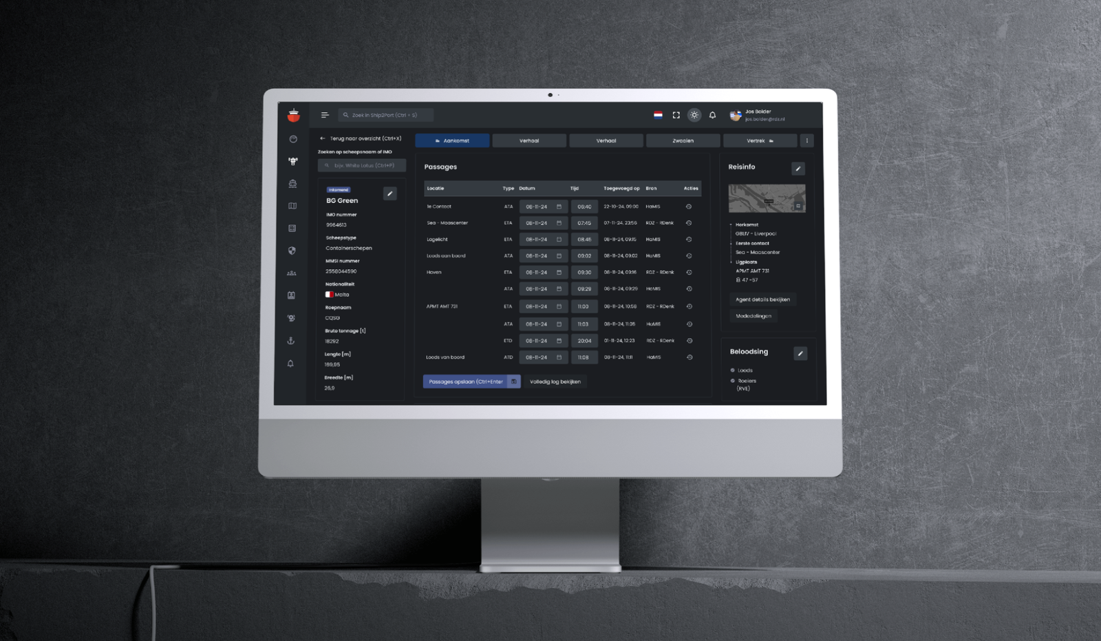
Port Management Software, reinvisioned.
For maritime company Royal Dirkzwager, a household name in the port of Rotterdam and beyond, we supported the transition from a legacy tool to a 21st century platform. In doing so, we developed a digital environment that made their crucial work, monitoring and updating ship movements easier and more intuitive than ever. For Rotterdam, and beyond.
The Project
Royal Dirkzwager wants their employees and customers to soon be able to work in a modern, new environment called Ship2Port. A critical part of this is managing ship information and movements in the platform. For this we performed an assessment, working with and for the user to develop a concept of how these data managers could best get started on this new platform.
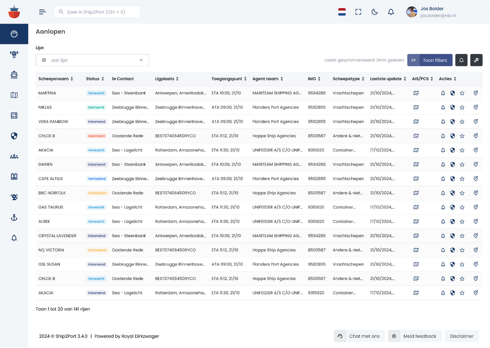
The Control Tower
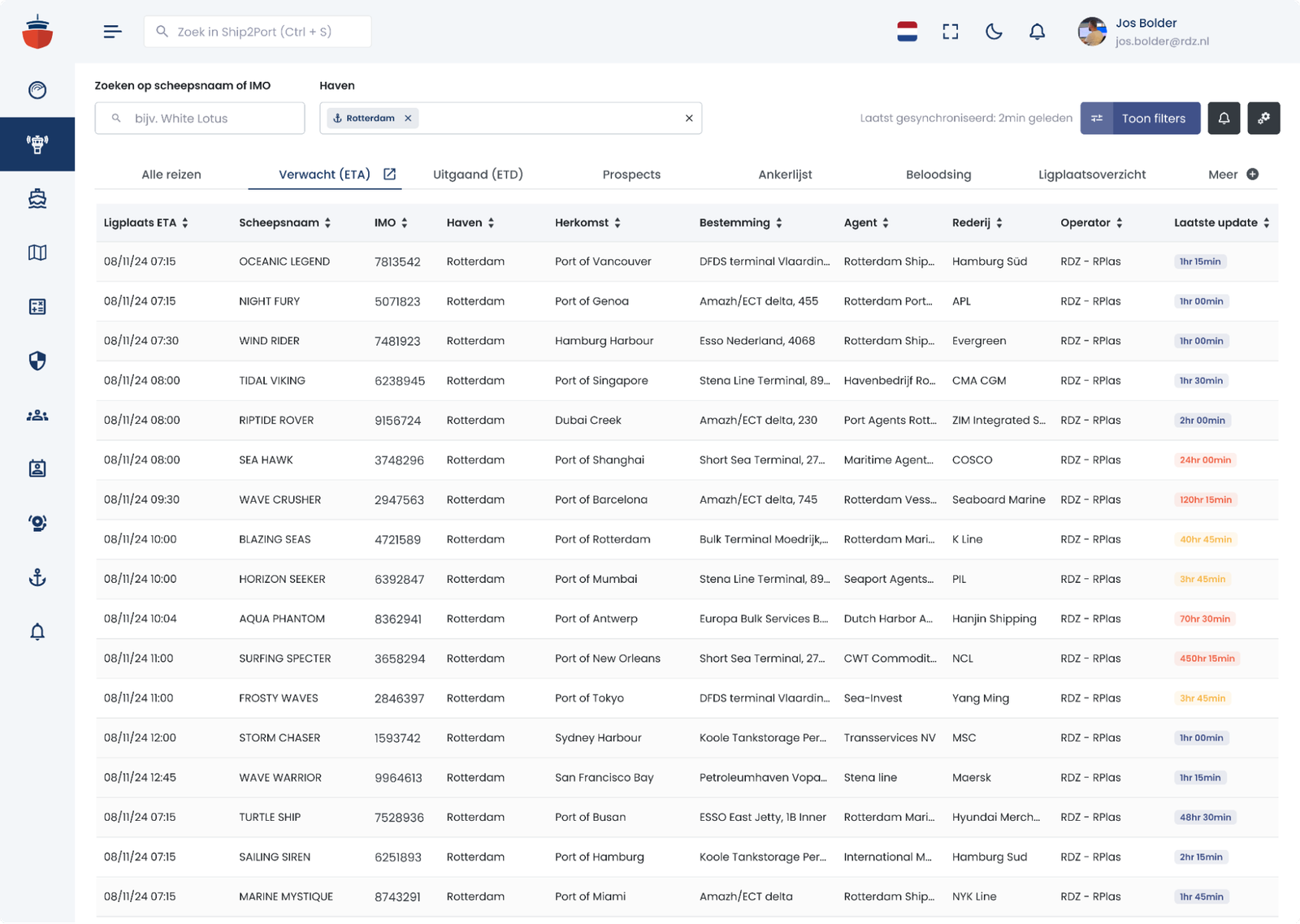
On the platform we introduced a place especially for data managers (= operators); the control tower. From this point they can view a range of location-specific information about ports and ships, fully tailored to the user's needs.
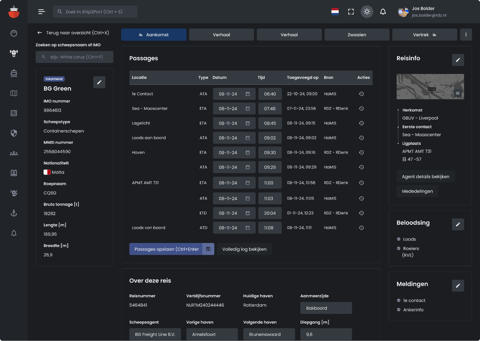
Updating ship movements; fast & effective.
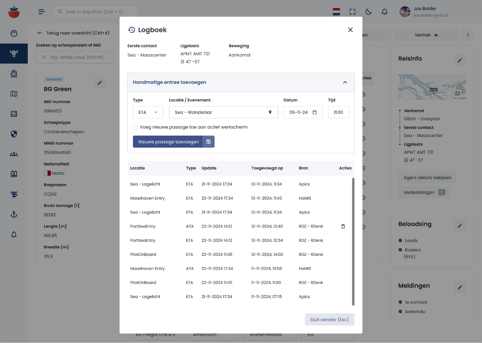
Monitoring ship movements is an important link in the entire logistics port process. Therefore, we designed a completely new environment on Ship2Port where an operator gets all relevant information about a specific voyage at a glance and can make changes important to agents, shipping companies and captains in one click.
Real-time map information of your fleet
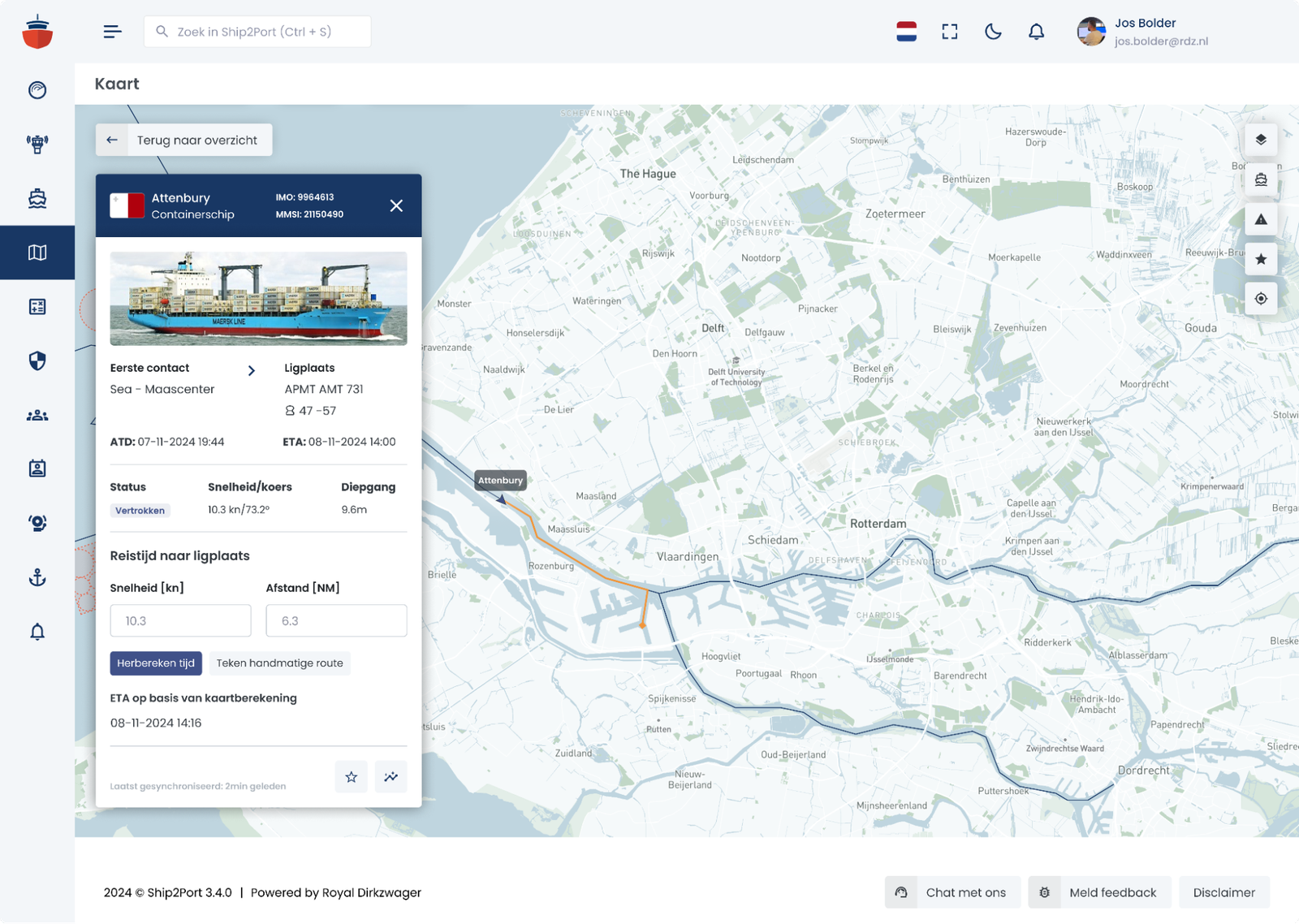
In addition to the reliable intel from experts, both operators and customers also use maps to gain information about the location and status of ships. Here, after the assessment, we added some valued features such as displaying waterways, ship names, and the ability to calculate an arrival time based on the number of knots and distance.
Wondering what else we did?
Of course, the platform is much larger and has much more functionality than the selection of screens we show here. We'd love to show you more!
